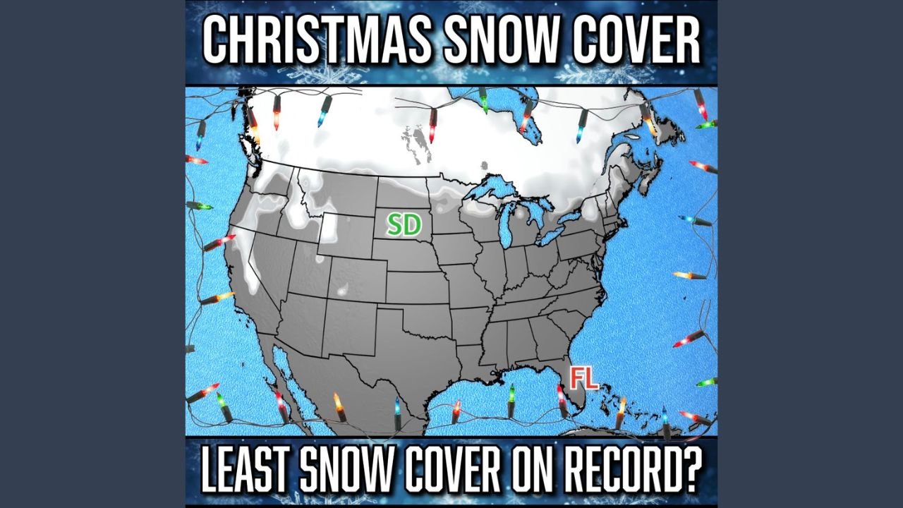
United States Sees Extremely Low Christmas Snow Cover as Florida, South Dakota, and Montana Remain Largely Snowless
UNITED STATES — New nationwide snow cover analysis shows that large portions of the United States are experiencing an unusually snow-free Christmas, with data indicating that Florida, South Dakota, and even parts of Montana near the Canadian border have little to no snow on the ground. Meteorologists warn this setup places the country on track for one of the lowest Christmas snow cover extents on record.
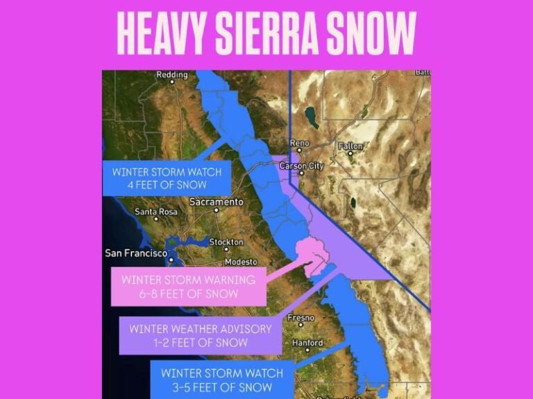
The imagery highlights a stark lack of white across most of the Lower 48, with meaningful snow cover confined mainly to parts of the northern Great Lakes, higher elevations in the West, and limited sections of the Northeast.
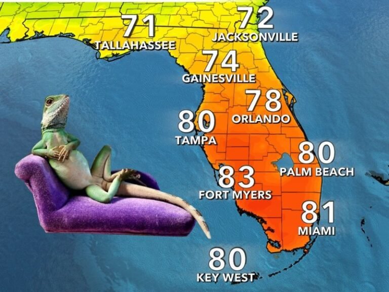
Florida: No Snow, but a National Benchmark This Year
Florida is highlighted on the map as entirely snow-free, which is typical for the state in late December. However, what makes Florida notable in this dataset is that its snow cover is effectively equal to that of several northern states, a highly unusual comparison for Christmas week.
While Florida rarely experiences snowfall, it is serving as a reference point this year for just how limited snow cover has become nationwide.
South Dakota: A Rare Snow-Free Christmas Setup
One of the most significant anomalies in the data is South Dakota, which is also shown with little to no snow cover statewide. This is especially unusual, as South Dakota typically maintains widespread snowpack by Christmas, particularly across central and eastern areas.
The absence of snow here reflects:
- Persistent above-average temperatures
- A lack of sustained Arctic air intrusions
- Minimal snow-producing storm systems
For a state accustomed to winter conditions by late December, this represents a major departure from seasonal norms.
Montana: Snowless Conditions Reach the Canadian Border
Perhaps the most striking signal in the data comes from northern Montana, where areas near the Canadian border appear largely snow-free. Northern Montana is normally one of the coldest and snowiest regions in the country during December.
This year’s pattern shows that even these high-latitude locations have failed to establish a lasting snowpack, underscoring the strength and persistence of the mild weather regime dominating much of North America.
Broader U.S. Pattern: Snow Limited to Isolated Regions
Beyond these highlighted states, the snow cover map reveals a broader national trend:
- Minimal snow across the central Plains and Midwest
- Patchy coverage in the Northeast
- Snow mainly confined to higher elevations in the Rockies and far northern tier
As a result, the majority of the continental United States is experiencing a “brown Christmas” rather than a white one.
Why Snow Cover Is So Low This Year
Meteorologists attribute this setup to a dominant warm atmospheric pattern, driven by frequent Pacific air flows and a lack of prolonged Arctic cold outbreaks. This pattern has:
- Kept temperatures above freezing in many northern states
- Turned potential snow events into rain
- Caused rapid melting of short-lived snowfalls
Without sustained cold, snow has struggled to accumulate or persist.
Historical Context and What Comes Next
If conditions hold through Christmas Day, this year could rank among the lowest Christmas snow cover years on record for the United States. While this does not eliminate the potential for winter storms later in January or February, it marks a notably slow and mild start to winter across much of the country.
Forecasters note that winter patterns can still shift quickly, but for now, classic Christmas snow will be limited to only a small fraction of the nation, with Florida, South Dakota, and Montana symbolizing just how unusual this holiday season has become.